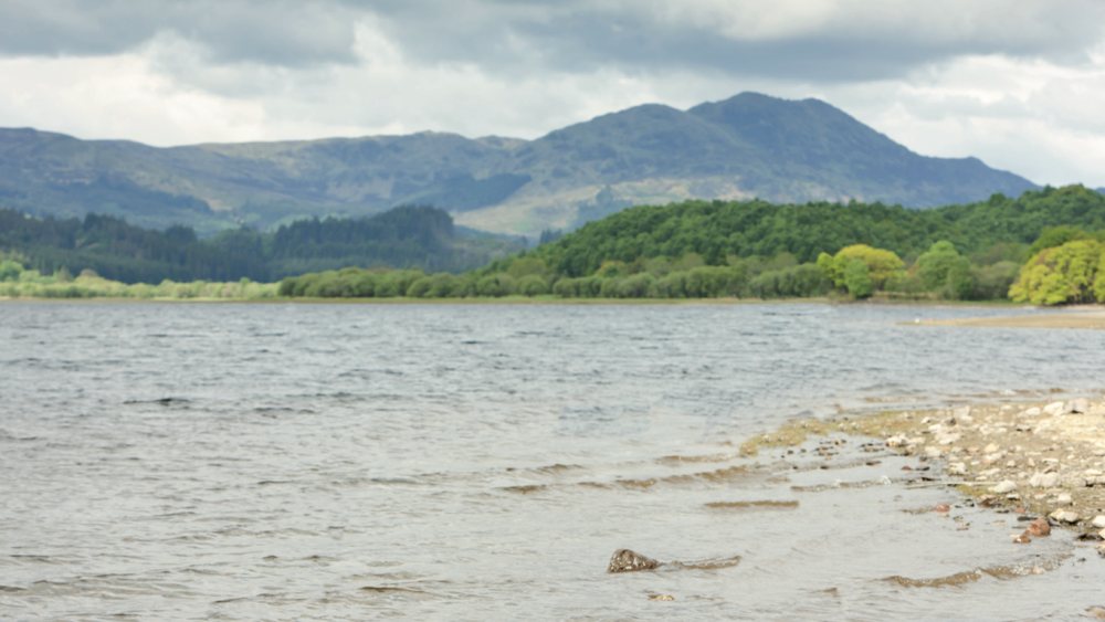
This is a longer walk, but with fine views of Loch Venachar.
It has been described in two sections as some may prefer to organise transport to pick them up at the east end of the loch rather than walking back along the south shore, around 5 Km of which is on a minor road.
17a – 8.5 Km (5 miles) with 300m (900 feet) of ascent. Allow 2½ – 3 hours*.
17b – 18.5Km (11 miles) with 400m (1200 feet) of ascent. Allow 5¼ hours.
Start Point – Brig o’ Turk.
Turn left from Tigh Mor to head towards Callander then, in just slightly under 2 miles, turn left into Brig o’ Turk and park behind the village hall (opposite the tea room). Grid Reference NN536067.
Note that most of the wayposts on this part of the walk have green oak trees with an included ‘T’ and winding path. The arrow shows the direction to take. In the instructions, these will be referred to as ‘T posts’.
*One way only – you will have to organise transport for your return.
WALK INSTRUCTIONS
FIRST SECTION 17a One way only – you will have to organise transport for your return.
- From the car park, return to the main road, cross it onto a pavement & turn left. In about 250m (3-4 mins) where the pavement ends, keep to the right, following T posts & blue wayposts along the path, across a driveway.
- Ignore two wooden gates on your right and in approx 300m (4-5 mins) you come back to the main road. Cross over, through the gate and take the path to the right (T post & blue/pink wayposts) across a boardway. Follow this path, which follows the line of road, to Point 1 the Glen Finglas car park & Visitor Centre, in about 800m (12 mins). Grid Ref NN546066.
- Just after the visitor centre, turn left across a broad wooden bridge, and once through the gate keep left, following yellow/orange/pink wayposts and ignoring the path on the right in a few metres. The path ascends through oak woods and in about 600m (15min) you will pass the ruined crafting township of Drippan after which the gradient eases.
- Carry on up the path, ignoring the one on your right in about 25m (yellow wayposts leading back to the Glen Finglas car park)*.
- At Point 2 the T junction in a further 300m (8 mins), where the orange/pink wayposts lead to the left, turn right to follow the T posts instead. Grid Ref NN545070. The path, well signed by T posts, now undulates along the hillside above the north shore of Loch Venachar.
- Ignore the path on your left, just after crossing a burn, in about 500m (7 mins) and also the one on the right in a further 300m (4-5 mins) and in a further 700m (11 mins) pass through a metal gate in a deer fence.
- You will pass through a second metal gate & deer fence in just over 1Km (16 mins) and 100m (1-2 mins) later come to a waterworks (a green shed surrounded by green fencing).
- Turn left on the track here which leads to a bridge/ford across a burn in just over 400m (6 mins).
- Cross the bridge and immediately afterwards, where the track bends right, carry straight ahead on a path through a metal gate in about 10m, to a T junction in another 10m.
- Turn right here and in another 10m take the left fork to pass round the corner of an old dyke.
- In about 50m (under 1 min) you will come to another metal gate. Pass through this and follow the track still running parallel to the lochshore.
- In just under 2 Km (30 mins) you cross a boggy gully on a low bridge and in another 250m (3-4 mins) come to another metal gate. Pass through this and follow the path round the base of Dun More (an iron-age fort).
- In about 500m (7-8 mins), just past a big boulder on the left, a track on the left climbs up to Dun More (a possible detour for lunch) and in another 100m (1-2 mins), you will come to Point 3 a T junction (Grid Ref NN602074).
- Leave the T posts here and turn right, (signposted ‘Invertrossachs’) to drop down to the road in approx 100m.
- This is the end of the first section, but note that if you were to turn left (signposted Callander/Samson’s Stone) at Point 3 the path leads almost to the Lade Inn (the final short section is on the road) in approx 1½ Km.
SECOND SECTION 17b
- Cross the main road and follow the minor road straight ahead, (signposted ‘Invertrossachs’). In approx 300m (4 mins) you will cross a stone bridge and come to Point 4 a T junction in the road (Grid Ref NN605071). Turn right here (signed ‘Invertrossachs’ & also Cycle Route 7 to Aberfoyle) to follow the road along the south shore of Loch Venachar.
- Ignore all roads, tracks or paths on your left and continue past two small carparks with picnic benches in just over 1 Km (16 mins), the end of the public road (East Lodge) in just under 1 Km (14 mins), the sailing club in 250 m (3-4 mins) and a Scout cabin in about 1¼ Km (just under 20 mins).
- In 1.4 Km (just over 20 mins) you will come to Point 5 a fork in the road at a large redwood tree (Grid Ref NN566050). The left fork leads to a white cottage in about 50m.
- Ignore both forks in the road and instead follow the path leading to the right, through a metal gate and signed (Cycle Route 7).
- In about 100m (1-2 mins) this crosses a wooden bridge by a green boathouse then winds along the loch shore for about 2Km (30 mins) without obvious landmarks, till you pass through a gap in a stone dyke and the woodland starts to thin.
- In just over another 1 Km (16 mins) you will come to Point 6 a barrier where the forest drive joins from the left (Grid Ref NN537055).
- Carry straight on (signed ‘Loch Katrine 4’) & follow the Forest Drive, ignoring the track on the left on the left in 400m (6 min) and at the junction in a further 100m (1½ min) keep right (signed Three Lochs Forest Drive), cross a concrete bridge, ignore another track on your left, then cross a cattle grid to arrive at Point 7 the junction by Achray Farm (Grid Ref NN529063) in a further 1Km (15 mins).
- Turn right through the gate, past the farm buildings (probably muddy), across the arched stone bridge and in about 400m (6 mins) you will come to the Byre Inn.
- From here walk up to the main road, turn right and follow the pavement back to Brig o’ Turk in approx 300m (5 mins).
 Nearest Train (or tube) Station(s)
Stirling, Glasgow
Featured Partners


