Walk Details
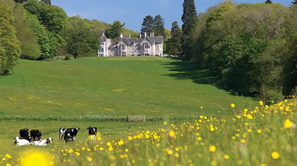
Cartmel Fell is a loosely defined upland area a short distance to the east of the lower part of Windermere. Bounded on the east by the Winster Valley and on the west by Gummers How, the Fell is a fine rambling area, with good paths, plenty of signposts and waymarks. Don’t forget the great views of the countryside, including the great limestone hump of Whitbarrow. The village of the same name however is not nearby!
This circular route takes in the best of the landscape; open hillside, woodland, some traditional buildings and two endearing little tarns. Overall this is quite an easy walk and is mostly flat. Apart from a few marshy areas and stiles, the tracks are all very good.
The focal point is the ramshackle St Anthony’s Church of 1504 which boasts a three decker pulpit and enclosed family pews. The very old glass in the east window is believed (as with some other churches in the area) to have come from Cartmel Priory when that great edifice was partially dismantled on the orders of King Henry VIII.
Start/car parking – Parking area beside the Cartmel Parish Hall at the approach to the church, grid reference 417882. From Merlewood head north to the A590.
Turn left onto the dual carriageway way and take the first exit. At High Newton turn right in the village to follow Height Road towards Bowland Bridge. After approximately three and a half miles go left at the fork. In about half a mile, turn left towards the Parish Hall (formerly the local school) and the church.
WALK
At the Institute, go through the church yard, turning left at the porch until you come to a seat, steps and squeezer stile. Follow the little path, rising to the road.
1. Turn right to walk along the quiet road for about 300m. Turn left at a farm gate and head up the hill on the wide track. There are rocky outcrops to the right and long views behind, over the Winster Valley to Whitbarrow and beyond.
2. Go left at the sign “public bridleway Sow How sign and towards the gate. At the next fork keep right, and continue up the hill. Ahead is an old building to your left. At the ‘T’ junction, turn right and head down into the woodland soon and through the gate. At a former bank barn/cottage (Heights Cottage), bear right to a waymark.
3. Turn sharp left here to head for a waymarked gate into the woodland.
4. At the next junction the way marked bridleway goes straight ahead. There’s a very short detour along the footpath if it’s wet and this takes you past the yellow waymark to the charming little Middle Tarn.
The path skirts the edge of the water before bearing left through the woodland, crossing a small stream to a gate. Continue along the foot of a steep bank on the right, passing a waymaker before heading down to Sow How Tarn and its boathouse. At a dilapidated stone wall before the tarn, turn left and follow the line indicated by a waymark, keeping close to the wall in order to reach the bridleway.
5. Then, turn right, and head downhill passing more waymarks before you reach a stream Turn right, continuing down the hill, until you reach the rapid waters from the tarn. The bridleway rises towards Sow How (farm) where you should go through the gate to reach a signposted junction.
6. Turn left to follow a farm track and head downhill. As you reach Foxfield hamlet, the path becomes a surfaced road.
7. After the hamlet, in about 400m, turn left to leave the road at a gate, which takes you down a grasslined path.When you reach the walls, turn right, through a waymarked gate between the stone walls. Go through another gate; the path covered in bracken. Cross Spannel Beck.
8. In a further 150m turn left onto a smaller path, cross a tiny stream and head up the far side of a mini valley. Go over a gated stile into the woodland.
9. Through the wood, cross the waymarked gated ladder stile, then take the lower path to another waymarked stile. The path now heads down to the minor road and over another ladder stile. Rejoin the outward route at point 1 returning to the car park by the same route.
 Nearest Train (or tube) Station(s):
Grange-over-Sands, Preston


