")

Walk Details
The second stage of the Wye Valley Walk starts in Llangurig. To avoid missing the last bus back we suggest you leave your car in Rhayader and catch the X47 bus to the start in Llangurig (or book a local taxi to take you to the start). There is plenty of parking available in Rhayader, including the Leisure Centre car park which you pass at the end of this stage.
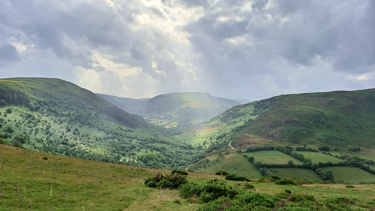
This has to be one of the most spectacular stages of the Wye Valley Walk as it takes us into the uplands of Mid-Wales and reaches the highest point of the whole trail at 480m above sea level.
Make sure you are well prepared for all weather conditions on this section as it is open to the elements!
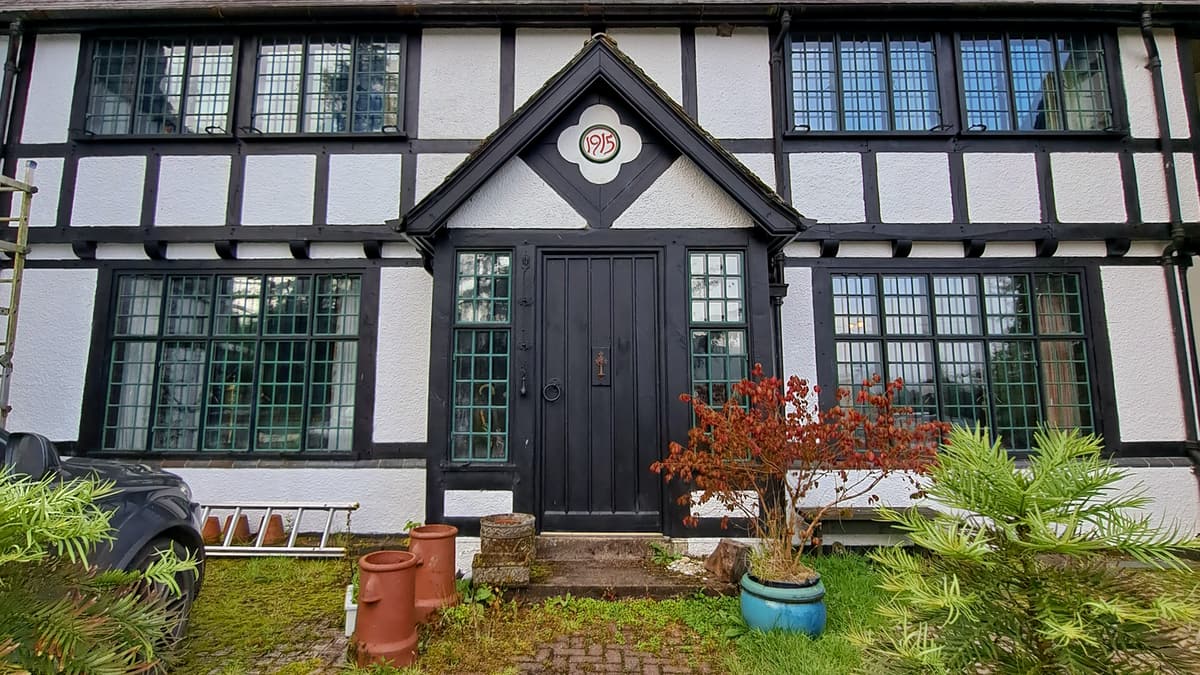
From Llangurig Bridge walk away from the village along the minor road. When the road forks bear right and stay on the road as it gradually climbs uphill, passing an attractive black and white house called The Clochfaen on your right. This is a rare example in Wales of an Arts & Crafts house designed by W.A.S. Benson, a leading figure in the Arts & Crafts Movement and a colleague of William Morris.
Where the lane bears sharp right, keep straight on between two large metal pillars and through a gate. The view opens out as you follow the farm track uphill, which zigzags right up to a gate. Turn sharp left to walk along the hedge. Go through the gate and head diagonally right downhill towards a gate. You can just about make out a gravel track from the top, which the gate leads onto. Go through the gate, cross the gravel track and immediately turn left down a path to a stream.
Cross the bridge over the Nant y Clochfaen and straightaway turn off the gravel track, heading uphill alongside a boggy ditch to the right, to reach a gate. Go through the gate and bear left climbing steeply and aiming for a pedestrian gate in the fenceline above. Go through this gate and continue walking straight uphill, heading for another gateway in the middle of the field, which soon comes into view. Bear right after the gateway heading diagonally across the field to a WVW signpost on the fence line at the top of the field. Go through the gate and head slightly right to a tall way marker. At this way marker post, follow the arrow to the right. You should be able to make out more posts showing the route over the moorland. At the next tall post look for a way marker on higher ground slightly to the right, which you reach by making your way across reedy, boggy ground. At the third marker post you are very close to the summit of Nantyhendy Hill – the highest point of the Wye Valley Walk.
Standing by the marker, get your bearings and head left (south) through the reedy tussocks to a stile and gate. Go over the stile and walk straight ahead, across a flattish section which starts to descend gently, so you can spot the next way marker and stile. Go over the stile and head slightly left towards the next way marker. Keep heading downhill in the same diagonal direction (southerly) until you eventually reach the fence line on your right, near the corner of the field. Continue to the corner (there may be a small livestock pen before the gates depending on the time of year) and then turn right, downhill between the gates following a fenced farm track. Go through the gate and continue steeply downhill at Blaen-y-cwm.
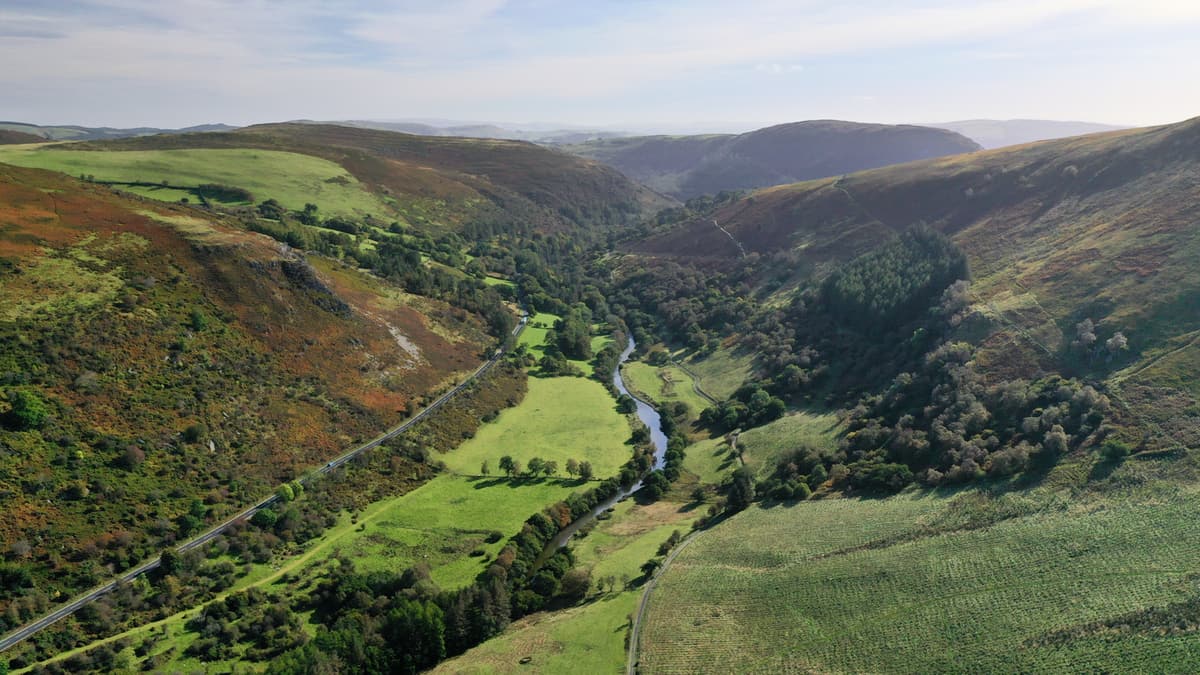
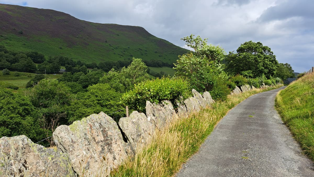
Go through another gate and keep straight on for a short distance until you meet a grassy track where you turn left. When you reach the tarmac road, turn left. Pass Tan-yr-allt. (gates may be closed on this lane section – so make sure you close them behind you). Stay on the road, crossing over two cattle grids, with a lovely stream flowing to your right. At the road junction keep straight on (right), continuing on until you reach another T-junction, just before a bridge. Turn right here and soon after left. The Wye now flows beside the road for a short distance. You’re going to stay on this road, which is lined in places with an unusual stone slab fence that is unique to this area, for about 3km, passing Safn-y-coed and Glyn Gwy. You may have to open and close gates. In late summer the hilltops to the left are clad with purple heather.
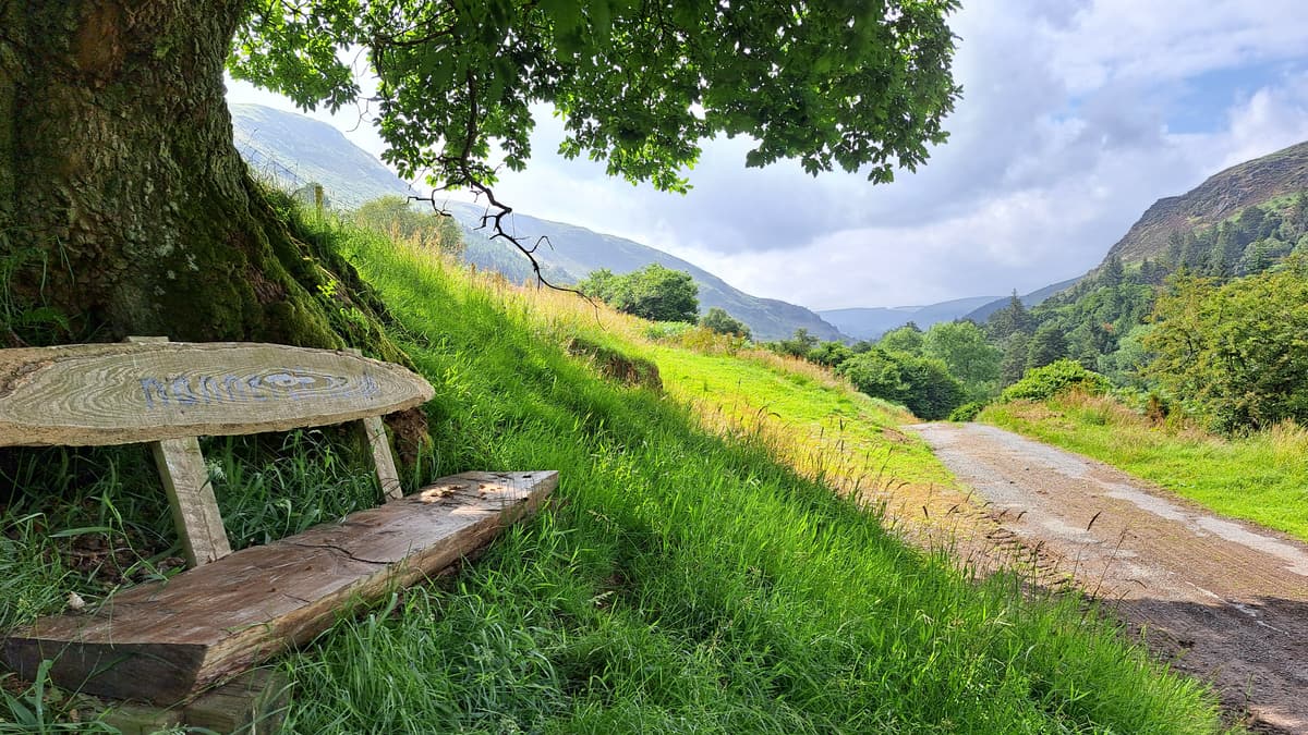
Around 2km after Safn-y-Coed look out for a bench under a tree on the right and soon afterwards a way marker on the left. This is where you leave the road, taking the footpath downhill on a grassy path which weaves through woodland trees and over rocky outcrops. Go through the gate and follow the path round to the right across the field, where there are remnants of stone slab walls. Look out for a way marker just after the ruined wall and bear left, following a sheep track around the contour line. When you can see a gate in the fence below to the left, head down to the gate. Go through the gate into a lovely stand of oak and birch trees and down to the bridge to cross the Wye. Follow the path up to the A470 and bear right across the carpark to cross the road at the entrance to Gilfach Nature Reserve.
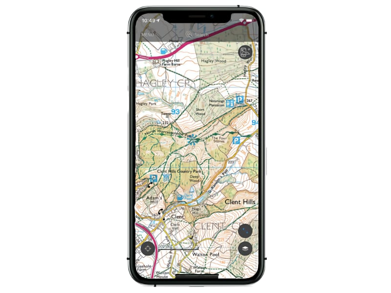
Please note that your Ordnance Survey map may show the old route of the Wye Valley Walk running to the south of the river Marteg. The official route stays on the north side of the river – so please follow the way marked route rather than your map here.
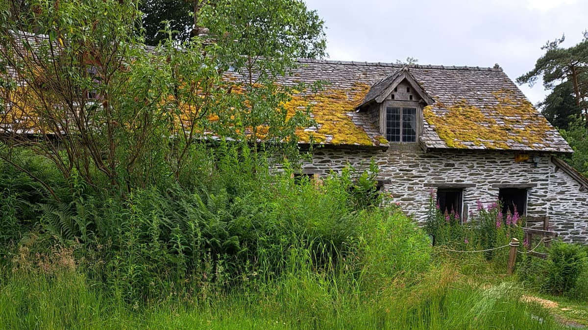
Walk up the road to a small structure on the right which offers a sheltered place for a picnic or coffee break (perfect if it’s raining!). Follow the path to the right of the road, along the nature trail and past an old railway bridge on the right. After a while you will come to a bench where you turn right downhill and through a gate to reach the Afon Marteg. Look out for the ‘wash pool’ on the right, this is where sheep were herded through the water to rid them of mud and insects before their fleeces were shorn. Pass the waterfall viewing platform on the right and the remains of a railway viaduct on the left. At the gate turn right over the bridge, passing the dipper hide, which is a wonderful place to pause for a moment to view these birds. When you’re ready, follow the tarmac uphill steeply to Gilfach farm. There is a bench half way if you want to catch your breath. Walk into the farmyard where you will find the Byre, which provides information about Gilfach Nature Reserve, toilets and picnic benches.
Walk between the longhouse and the barn up to a signpost. Go through the gate and turn right (it’s signposted Rhayader). Note the stone slab fence along the path here. Go through the gate and follow the grassy path uphill diagonally. Close to the top, when you can see the fence line in front, the path forks gently left to a marker post, which you can’t see until you are close to it. At the marker go straight ahead to go through a gate/stile. To the left you can see a motorsports track. Follow the track downhill through a series of gates. At the final gate turn right onto the road and follow the road downhill.
There is a sting in the tail to this section – an unexpected steep uphill just when you think you should be at the end! The saving grace is that the road is lined by gorgeous oak woodland. When you reach the outskirts of Rhayader, continue to the road junction. Turn right to walk down to the town centre, passing toilets and the leisure centre on the left. At the junction turn left and walk down to the crossroads and clock tower where this stage ends.
If you need to get back to the start and your car – you can catch the X47 bus from Rhayader back to Llangurig.
Read more ...