In 2019, a major review of the National Parks was conducted by Julian Glover: it’s aim, to “reignite the founding spirit” of our great National Park movement in order to make them greener, more beautiful and open to everyone. In the report Mr Glover writes about “the need for improved accessibility for visitors with disabilities to our Parks and AONBs.”
Many of the National Parks publish ‘Easy Access Walks’ or ‘Miles Without Stiles’. These walks have been audited by their accessibility experts as to the suitability of the walk for different types of disability and for different types of wheelchair. However, there is a growing demand for ‘stile free’ walks. I receive lots of emails from people from around the UK who want to know about the location of walks without stiles – not because they are a wheelchair user, but because, for example, their dog cannot climb the stiles or that an injury prevents themselves from climbing steps. Parents with children in buggies can follow the stile-free walks. I know a family who look for the accessible routes as they carry their little one in a baby carrier and say how difficult it is to negotiate a stile safely with a child strapped to their back.
I have asked some of my Ordnance Survey Champion friends and Neil Warren, from Countryside Mobility to share a stile free walk for each of the 15 National Parks. I am delighted to share them with you. I must stress that these walks may not necessarily be suitable for wheelchairs. Some of the routes have not been audited as to their suitability for wheelchair users. They are simply … stile free walks.
Princetown Railway Walk, provided by Fi Darby
Princetown, with its famous prison and misty microclimate, is thought by many to be the centre of Dartmoor National Park. The visitor centre here is fantastic (and accessible) and only a short distance from the start of one of Dartmoor’s most popular stile free walks.
This ‘there and back’ route can be as long or short as you like. From Princetown’s main car park, follow the lane west past the fire station. You’ll see a footpath that continues west and through a gate. Follow this until you’re on the old Princetown branch line, now popular with walkers and wheelers alike. As you spot North Hessary Tor to your right then follow the railway to loop around the impressive King’s Tor, you’ll feel as though you are right in the middle of the grassy moor. Watch out for Dartmoor ponies and skylarks.
To find out more about Fi and her love of the outdoors, please visit: fidarby.co.uk/portfolio/outdoor-writing
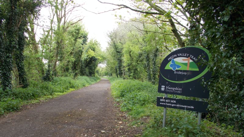
The Meon Valley Trail, provided by Glyn Dodwell
The Meon Valley Trail is a linear walk between West Meon and Wickham. The trail follows a 9-mile section of the former Meon Valley Railway which closed in 1968. There is no route as such because you just stick to the path. There are plenty of points along the route where you can start or finish making a series of shorter walks.
During the late spring, a 30-minute walk from Wickham takes you to the most amazing Blue Bell fields deep in the woods. South of Droxford is a siding where Churchill met with allied leaders on the eve of D-Day
To find out more about Glyn: onthehills.uk | Follow Glyn Instagram: glyngetoutside
From Horsey Gap to Winterton-on-Sea, provided by Chris Webster
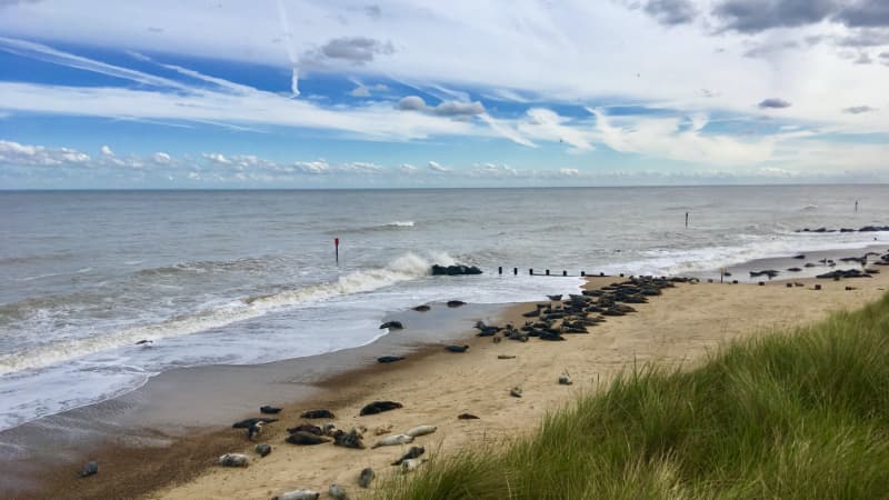
A relaxed coastal walk connecting the natural hotspot of Horsey Gap and the desirable village of Winterton-on-Sea. Starting at the large beach carpark at Horsey, this is the home of one of the countries biggest grey seal colonies and between November and February the beach here is littered with seals and their pups. The walk is on a mix of nice solid bridleways and good solid paths which criss-cross the backs of the dunes. Take time to stop at the fantastic cliff top café in Winterton which has great coffee, cakes and lunch bites. It’s also a good spot to use the public toilets before returning the way you came back to Horsey.
Find out more about Chris at geographyfieldworkacademy.co.uk
Follow Chris on Facebook and Twitter: @gfasouthwold
Loch Morlich, provided by Charlotte
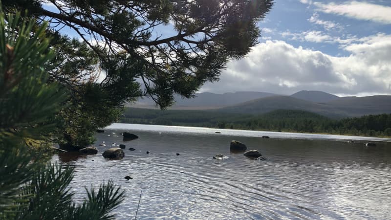
Allow yourself an hour to meander through the pine, birch and alder woods down to Loch Morlich’s golden granite sands of the Cairngorm Mountains. Make sure to keep an eye out for red-throated divers, otters, heron, sandpipers and wagtails as you take in the spectacular views of this beach lying 318m above sea level. The route is mostly flat, largely wide with a surface of tarmac and gravel, there are some short fairly steep slopes and two road crossings involved in this walk. There is parking at the start of the trail and accessible toilets at the Glenmore Visitor Centre as well as the essential café and souvenir shop! Do make sure to make the most of hiring a 4 wheeled mobility scooter free of charge from Badenoch & Strathspey Community Transport Company.
Find out more about Charlotte at: prowexplorer.com
Follow Charlotte on Instagram: @publicrightsofwayexplorer and Facebook: @PROWExplorer
Heddon Valley, provided by Neil Warren from Countryside Mobility
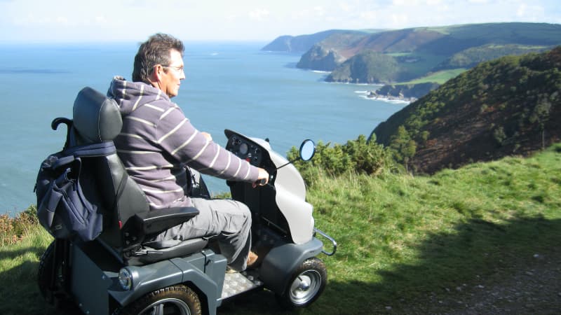
Exmoor National Park includes some of the highest and most spectacular points along the English coastline. The walk from Heddon Valley offers the perfect opportunity to access this. Starting from a peaceful wooded valley it uses a 19th carriageway to gently climb up to dramatic clifftop views across the Bristol Channel to Wales. Cared for by the National Trust the route can be accessed using the two all-terrain mobility scooters (Trampers) available to hire from their shop in the Valley, through a partnership with the Countryside Mobility initiative. With a second Tramper route leading down the river valley and the historic Hunters Inn to enjoy at the end of explorations it’s no surprise that Tramper users recently rated this as one of their favourite locations.
To find out more about Neil, please visit: countrysidemobility.org
Follow Countryside Mobility on Twitter at @CMSouthWest
St David’s and St Non, provided by Phillipa Cherryson
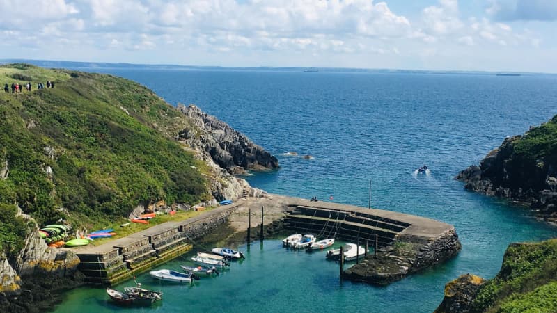
This walk takes in a section of the Pembrokeshire Coast path linking Porthclais and St Non’s and then onto St David’s. It is stile free with just a rough section of path at the start. Car park at Porthclais with toilets.
Turn right to follow the coastal path towards St Non’s. Its a little rough initially but soon levels out with great views.
At a junction before the path descends to St. Non’s Bay, turn left through a gate, to cross a meadow on a grass track, heading for the ruin of the ancient St. Non’s Chapel, said to be the birthplace of St. David. Continue to another gate, giving access to St. Non’s Well. Pass the Well and then pass below a retreat centre. The modern St. Non’s Chapel can be visited by a short detour to the left.
Carry on along the path, soon rejoining the coast path. Turn left immediately at a ‘footpath’ signpost to follow a clear track, heading inland. The path runs between fences and old field boundaries, with gates. When you reach St David’s follow the lanes round the edge of the city, past the cemetery and to the cathedral.
Start your return by heading down Goat Street for a short distance until you reach a footpath on your right hand side.
Keep on that path, and go through waymarked gates. Follow the footpath signs through the Porthclais farm and keep close to the field boundary on the right to head for a gate. The path across the next meadow is just visible on the ground.
Pass a waymark on a post, go straight ahead at a cross-path and descend the valley side on a steep but good path. Join the road, turning left to cross the stream and return to the car park.
Follow Phillipa on Instagram @phillipacherryson
Fritham Circular, provided by Phillipa Cherryson
The Fritham circular walk is a popular walk within the New Forest with good reason.
You start at the picturesque village of Fritham, with a scattering of cottages, farms, a chapel and the charming thatched pub – the Royal Oak. Then the trail leads through ancient woodland onto open heathland and a remote part of the forest with a surprising history.
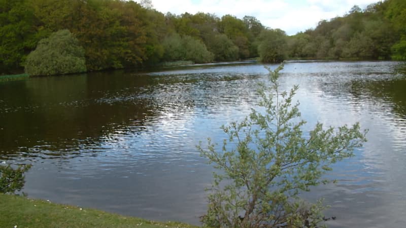
Park in the car park at Fritham, just past the pub. Turn left out of the car park and head down the road. Go past Eyeworth Pond on your right – it’s a gorgeous spot and well worth stopping at.
Continue straight on past a wooden barrier leading into Eyeworth wood. Follow the path for just over half a kilometre. It can be muddy after wet weather. Head out into open heathland and after another 500m you’ll see the track branches at a stocky Scots Pine tree.
Take the left fork here and follow the path through a valley and up to the car park at Telegraph Hill.
From the car park, head diagonally left on a broad gravel track across the open heathland. Keep going and you’ll pass a deep pool on your right and then an ancient tumulus. Then you’ll notice a brick shelter. Stop here to have a read of the information within it. You are at Ashley Walk Bombing Range. During WW2 this area was a massive bombing range and just about every type of bomb was tested here.
Continue along the track until you reach a junction. Turn left here onto a cycle path. Follow this well made gravel track all the way back into Fritham.
There are no toilets at the car park at Fritham. But the Royal Oak Pub has excellent disabled toilets in its grounds and serves lunch and real ales. It’s best to phone ahead to book.
Follow Phillipa on Instagram: @phillipacherryson
Great Shunner Fell, provided by Debbie North
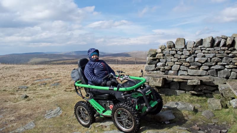
Great Shunner Fell stands at 680m, making it the third highest mountain in the Yorkshire Dales. This route follows part of the Pennine Way, along the bridleway to the Summit.
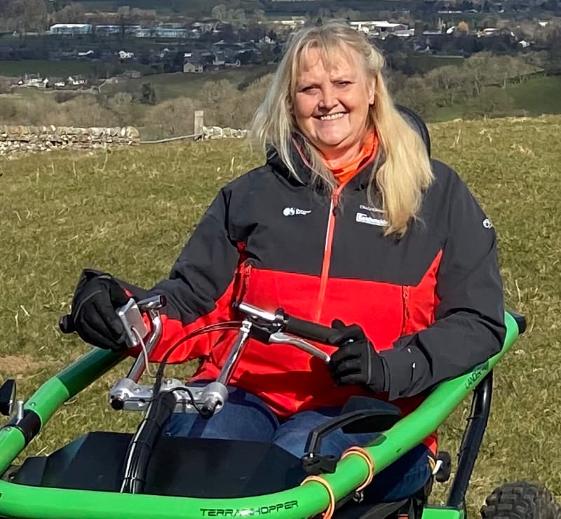
Guaranteed stunning views over Wensleydale and over to Cotterdale and beyond, this walk is ideal for someone who enjoys a challenging climb. I used a TerrainHopper (a sturdy 4×4 all- terrain wheelchair) for this walk. The route starts at Hardraw and follows the bridleway. The start on the track is wide but uneven. It is a gentle climb all the way to the summit.
Sutton Bank, provided by Debbie North
The linear walk across the escarpment at Sutton Bank begins at the other side of the busy road. Take care when crossing this road as the traffic moves very fast. The track is wide and made of compounded aggregate which is ideal for all types of wheelchair. There are no gates along the way and the slope is very gentle all the way along this one and half mile track.
Monsal Trail, provided by Yvonne Witter
The Monsal Trail is ideal for family walks and suitable for wheelchair users with level access at Bakewell, Hassop and Miller Dale stations (disabled toilets at Bakewell and Millers Dale).
The route is flat and there is plenty to see and learn about the old railway which was built in 1863 to link Manchester with London and closed in 1968.
The tunnels were formally opened on 25 May 2011. There are various information points along the way.
There are numerous landmarks including 4 railway tunnels; Headstone Tunnel, Cressbrook Tunnel, Litton Tunnel and the Chee Tor Tunnel.
Start at Hassop Station | Ordnance Survey grid reference: SK 2175 7053
Follow Yvonne on twitter: @CHAMPIO51749703
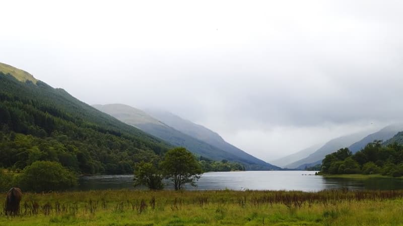
A walk along the Shore of Loch Lomond, provided by Debbie North
This walk starts from the Carpark at Firkin Point and follows the cycleway. It is a perfect walk for wheelchairs and pushchairs. Accessible toilets are available in the main carpark.
Find out more about Debbie at theoutdoorguide.co.uk/access-tog
Follow Debbie on Facebook, Instagram and Twitter at @accesstog
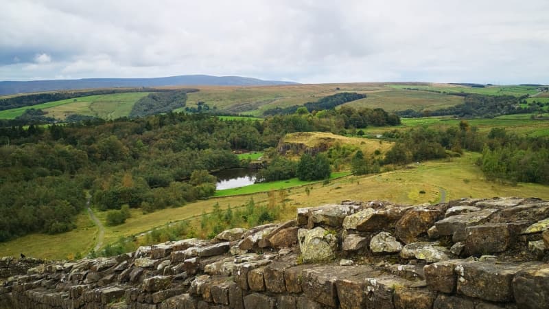
Walltown Nature Reserve, provided by Dave Wilson
This short walk (2km) enjoys the peace and seclusion of the Walltown nature reserve, sitting in the shadow of Hadrian’s Wall. Walltown is a former 19th century quarry, which cuts through the former route of the Roman wall. The east end of the walk allows visitors to leave the site and explore the views of the wall and beyond into Northumberland National Park. The walk also features woodland, wildlife lakes and the popular Willow Peace Labyrinth. There is also a newly refurbished visitor centre (check opening times).
Follow Dave on Twitter at @GreatNorthDave
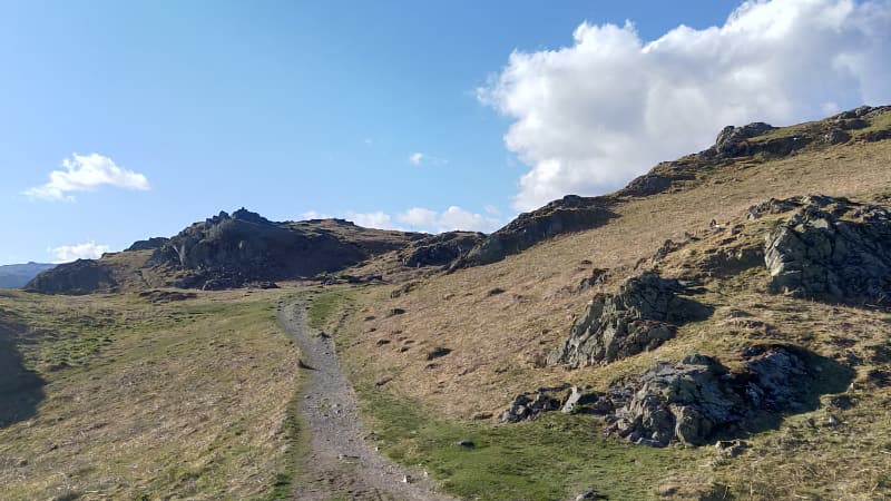
Loughrigg, provided by Harrison Ward
Alfred Wainwright described Catbells as a “family fell” yet arguably Loughrigg is tailor made for all shapes and sizes. A relatively low summit with panoramic views including vistas of the Langdales and the Greenburn Valley. This central fell offers something for all.
Loughrigg can be accessed from a multitude of angles but the most accessible is certainly directly from Ambleside. A bustling town with many amenities and an abundance of car parking. Beginning from the centre, a short walk through Borrans Park takes you across a small pedestrian bridge onto an access only road. From here there is a relatively steep yet smooth road-cum-path that ascends up and onto the many peaked knolls.
Although gates are present numerous times upon the journey up, they are large and able to be opened fully so would cause no issues to families or individuals using all kinds of wheels. Once the sight of the town and scarce hill properties have disappeared the route change from a smoother gravelly path to a grittier naturally worn one. There is one section that may cause mild difficulty as you head West up on the higher section of the walk, although it can be navigated to avoid the larger rocks.
From here, circular views of open water become apparent. Windermere, Grasmere, Rydal Water are the main ones of note with smaller tarns also visible. A short, carved path on the grassy top meanders towards the summit cairn with little difficulty or further ascent. I highly recommend taking a slightly NW route from the summit to get a spectacular scene overlooking Loughrigg Terrace onto Grasmere with the central fell spine in plain view in good conditions. Unfortunately, this path is a difficult, steep, stepped return to lower ground so it is advisable to return following the same trail to arrive back in Ambleside.
Find out more about Harrison: howdo@fellfoodie.co.uk
Follow Harrison on social media at @fellfoodie
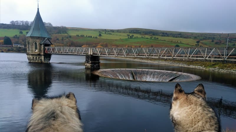
A circular walk around Pontsticill Reservoir, provided by Tracey Purnell
Situated approximately 5 miles from Merthyr, Pontsticill reservoir was opened in 1927 by Lord Buckland of Bwlch. The reservoir is so large, some people mistake it for a lake. There are good tracks around the reservoir and is a popular place for family walks; ideal for wheelchairs, buggies and bikes. There are plenty of places to stop to admire the views and to take a picnic. A beautiful circular walk with stunning views guaranteed.
Follow Tracy on Twitter at @ashermarley
Cwm Idwal Nature Reserve, provided by Lisa Wells
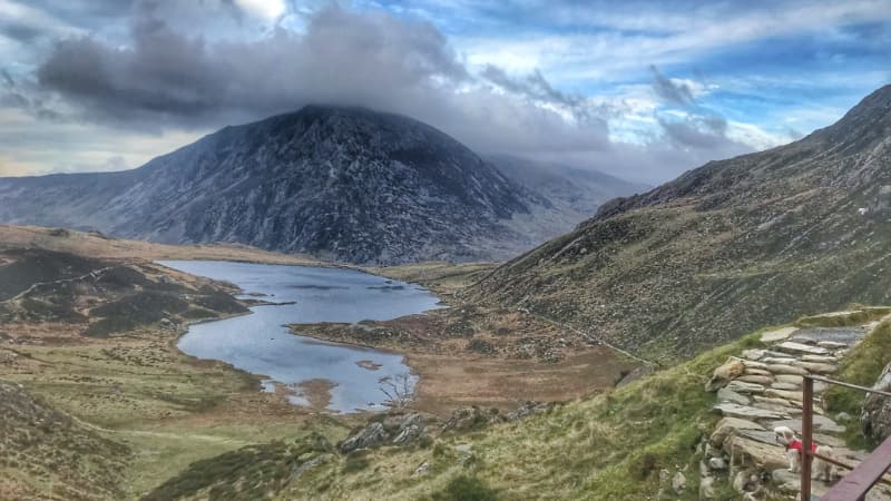
A lovely stile free walk full of history and the myths of Wales. There’s a P&D carpark at the start of the walk, a tourist information centre and a small snack hut.
It’s a fairly flat walk, on an easy to follow path with beautiful views of the Glyderau and Carneddau mountain ranges.
At a leisurely pace the walk will take approximately 3 hours to complete with a total distance of 4.5km.
It’s home to the famous Snowdonia Lily and where Edmund Hillary practised climbing before his Everest ascent. You can walk amongst the friendly Welsh Black herd and where legend has it that no birds will ever fly over Llyn Idwal.
Take the time to snap photographs, enjoy a paddle in the Llyn (lake) and finish your day of with a piece of cake and a cup of tea. A perfect day out.
Follow Lisa:
Instagram – www.instagram.com/lisawells00/
Facebook – www.facebook.com/lisawells00/
Twitter – www.twitter.com/lisawells00

