- Home
- All Walks · Walking Routes
- Walks by Region
- Walks in Yorkshire
- Mossdale & Cotterdale Walk, Yorkshire…
Click to zoom …
Walk Details
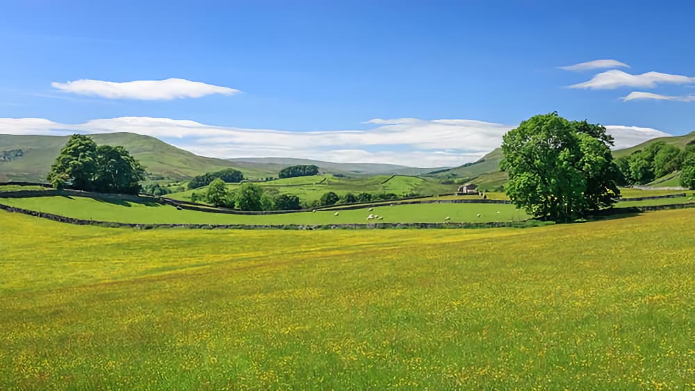
This outing commences from Appersett, a small hamlet resting on the A684 road, about a mile north-west of Hawes and takes in two reclusive areas – Mossdale and Cotterdale.
Mossdale contains a sprinkling of farmhouses and displays some spectacular waterfalls around Mossdale Head.
Cotterdale houses a small community in a hamlet which many years ago was called Cotter Town. An air of peacefulness pervades.
Leaving Appersett on the A684, there are two bridges about two hundred yards apart. Cross the first bridge and follow the A684 to a ladder stile on the left just before the second bridge, signposted to Mondale Head. The path accompanies the wall towards the river Ure then swings left, upstream. Keep close to the river until a ladder stile is reached, then veer diagonally left across the field and rise, around the topside of a copse.
A clear path unfurls, crossing several stiles, with Widdale Fell prominent, to arrive at a ladder stile crossing the wall on the right. Descend into a small copse and cross a stream, then swing left towards a gate situated alongside a barn. Cross the next field aiming for a gate in the far right corner. Turn left along the farm access road.
When the road swings (right) towards the farmhouse (Birk Rigg farm), veer left and pass through a gate. Ignore a left turn towards a railway bridge, soon after to maintain the previous course until the track divides close to a ruined barn – veer left (straight on) at that point.
The track descends and passes through a gate (ignore footbridge) and eventually curves left. Seek a footpath sign situated on the right beneath a banking, and follow the direction indicated. Pass through a wooden gate then follow the waymarked route to Mossdale Head farm, again avoiding a footbridge along the way. Some wonderful sights hereabouts. Cotter End, the Ure and some super waterfalls, if your luck’s in!
Pass through the farm, cross Mossdale Beck (wonderful waterfall beneath viaduct) and pass through the gate directly opposite. Follow the indication of the signpost (right) up the bank towards a wall and swing right to pass over a stile. Proceed straight ahead, passing two marker posts before descending to the road and Thwaite House.
Cross the Hawes-Sedbergh road and Thwaite Bridge then march (half right) up the banking towards Cotterdale. Lots of primroses hereabouts in season.
Once over the ladder stile the exhilarating crossing of Cotter End gets underway. Aim to the horizon left of the beech copse, seeking a ladder stile. Go straight on for 20 paces, then after crossing a well-established track veer slightly right and make towards a conspicuous waymarker, standing on the horizon. The way to Cotterdale is straightforward from that point, just locate the ladder stiles. This is another superb viewpoint.
Reaching the road don’t cross the cattle grid. Instead, make for a stile 10 yards away (signpost). Drop towards the beck, seeking a narrow stile in the wall to your left. Pass through a gate sited alongside a barn, then cross a “Monet” style bridge seeking a stile located where the wall and a wire fence meet. Follow a beckside path towards the houses (no M&S or Tesco hereabouts!) Turn right.
The hamlet, formerly known as Cotter Town originally housed a mining community. In those times there were three principal families – Hall, Kirk and King. A rhyme relates them and the remoteness of the hamlet: Three halls, two kirks (church) and a king; same road out as comes in.
Follow the road beyond the houses, noting the tombstones in the garden of a house close to Shepherd’s Cottage. The site was formerly a Methodist chapel. Cross the wide bridge to begin the steep climb amid the conifer trees. There’s no way marking, so pay attention! March uphill for almost ½ mile then swing right at the first opportunity. Soon after this manoeuvre turn left. The upward course continues and swings right, again. Now walk straight ahead to arrive at the exit gate (complete with map!).
Emerge onto Abbotside Common (an association with the Abbot of Jervaulx Abbey) swing right and stride out majestically, high above Cotterdale. Note the shake holes (subterranean landslips) on the left of the track. The tall obelisk sitting on the left hand hillside isn’t visited during this walk.
The delightful grassed swathe is followed until a Pennine Way signpost is reached. At that juncture make to a gate several yards beyond and continue in the same direction. The views of Wensleydale and the surrounding hills are impressive as the track descends to another gate. This leads into an enclosed lane, which is followed for 300 yards towards a signpost on the right, to New Bridge. Appersett should be in sight.
Descend to a ladder stile, then follow the waymarkers across the lower flanks of Bluebell Hill and return to Appersett walking along the road.
 Nearest Train (or tube) Station(s):
Garsdale, Carlisle
Local Information
Read the Countryside Code before venturing out
Make sure to take a map and compass, and know how to use them before going into our National Parks #BeAdventureSmart
Tips for New Walkers: click here to download (PDF).
Remember to prepare properly before heading out on any type of walk or outdoor activity. Tell people where you are going and what time you are expected back. As Wainwright says "There's no such thing as bad weather, only unsuitable clothing".

