This trek is a 6.5 km (4 miles) circular walk around the village of Binsted and nearby ancient woods, situated west of Arundel this parish has an immense amount of history. Parking is limited in the area, but the walk can be started at various points on the route. Sadly, this walk will look vastly different in years to come as it will be altered forever when the A27 bypass is constructed, cutting through this ancient and tranquil landscape.
This trek starts at the 12th century St Mary’s Church, a flint building that stands high and looks across the steep sided Binsted Rife Valley, which is thought to have been formed in the last ice age by glacial water running from the South Downs, it is now a rare chalk stream fed from nearby springs.
Follow the quiet lane northwards keeping the fields to the right and views across the valley to the left. On the far side of the valley are remains of a Roman villa and bath house and barely visible are Iron Age earthworks that run North/South and formed part of the Chichester entrenchments.
The lane passes the popular Black Horse pub which has been at the heart of the community for generations, it sheltered villagers during WW2, has been the venue of Music Hall sing-alongs and today serves great food in a terrific setting. The field opposite has the buried remains of a tile kiln that once produced ‘Binsted Ware’ pottery, traditionally known for its jugs with faces on the handles.
A little further north is a fork in the road where Hedgers Hill meets Binsted Lane. This area was known as ‘All the World’ and would have been a busy junction between other medieval tile kilns situated in the area. Take the lane to the right and head round the bend, the woods to the north of the lane called Hundred House Copse contain earthworks believed to be the remains of a Moot Mound, an Anglo-Saxon meeting place. The mound is also situated right next to further iron age earthworks. If taking a detour into this copse then it is essential to keep to the path as this area is also used by archery clubs. On the bend take the bridleway eastwards known as Old Scotland Lane, so called because the adjoining land may have owed a customary payment (or scot) on it. Scotland Lane was also identified in the 1940s as the route of the Roman road from Chichester to the Adur, but recent surveys suggest that the road may be slightly to the north.
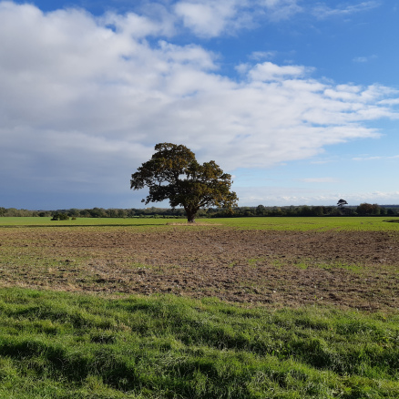
Follow the path along the edge of the field, look towards the middle and see one of the many great oak trees that are scattered around the locality. At the far side of the field enter the 250 acres of ancient woodland that is Binsted Woods. Follow the straight path further into the unkept deciduous wood and keep an eye out to catch a glimpse of its abundant wildlife. Notice the change in the smell of the woodland as you cross the parish boundary into Tortington and enter the pine plantation. At the road junction you can either head south or stroll through Tortington Common to the Madonna Pond. Much folklore surrounds this pond one saying that it is bottomless and has swallowed up many a person. The Madonna statue was originally erected in 1952 by Lorna Wishart a local artist, unfortunately the original statue was vandalised and has since been replaced.
The walk heads back through the southern part of the woods following ‘Lovers Walk’, part of a 19th Century path that linked the church to Arundel. Leave the woods and head across the fields taking care not to miss the wooden Waymarker sculpture by the junction of four paths at the end of Church Lane. The Waymarker depicts the Green Man, bubbles arising from the Knucker Hole and the dragon/serpent that lived there.
Head back along Church Lane to the church to complete the trek.