Click to zoom …
Walk Details
Pentraeth is five miles west of Henllys. A village of many amenities, including a bakery, petrol station, church and the ‘Panton Arms’, where Charles Dickens is reputed to have made one of his innumerable overnight stops – in 1859.
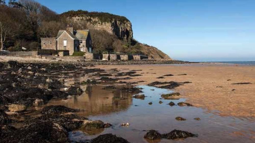
This ramble takes in the beautiful Red Wharf Bay, and the sprawling Pentraeth Forest, said to house red squirrel, buzzard, sparrow hawk and peregrine falcon. Red Wharf Bay is undoubtedly a spectacular location.
Rich coloured sands, stretching for three glorious miles. The tiny hamlet of Llanddona is an optional extra. For that reason it has been excluded from the route set out. A short detour is included, for those wanting to risk finding the pub open!
There’s a car park close to the traffic lights. From here we’re following the Heritage Footpath route, down a secondary road. Crossing the road bridge, we then turn right at a waymark.
Continuing along a vehicle track, we’re heading towards the sea with Pentraeth Forest away to our right. After the cattle grid we leave the track on the left, to walk across two fields, then along an enclosed lane before following the driveway to the beach. Turning right, we cross a bridge. Turning right again when we reach a junction, and then left at a post box soon after.
We continue walking along the road, eventually passing farm buildings on the right, to arrive at an obvious junction. Here we veer right (waymark) along an uneven track towards a cottage (Tyn Gait) and beyond it (will emerge from lane on right later) another junction. We’re going to take the left option, and a bit later follow the signs to Tyn Coed.
The path rises, then descends to the left, merging with another track. We follow the path down and keep going along an often damp route to reach two properties. Head right (waymark) maintaining the previous line, go through three kissing gates to then cross a ladder stile where we turn left to pass Côch-y-mier cottages (can’t see house until later). Follow the path around the paddock.
We exit along the driveway and turn right at the road. Passing through the village, continuing upwards, looking for the access road to Bryn-castell on the right. (If you’d like a detour to Llanddona keep going further up the road and use the stile with handrail, located on the left).
Pass to the left of Bryn-castell buildings, we then walk along a narrow grassed path between low stone walls (may be overgrown) and pass through a gate to the left. On a clear day you can get distant views of Snowdonia here. We’re veering half right across the field.
We pass through gorse bushes looking for another gate in the middle of the fence (not the corner of the field) then go across the field. Make your way towards the farm buildings (Hafoty) and the exit gate that’s 50 yds to the left. Here we need to cross a massive ladder stile opposite, then cross the corner of the field and pass through a wide gate.
Keep to the boundary fence (to left) here until we come to another ladder stile, then continue straight across the next field, looking for another ladder stile, tucked away in the distant corner to the left. Cross that stile, then we swing to the right, ignoring the stile on your left keeping close to the hedge on the left.
We need to cross two additional ladder stiles, to arrive at Rhôs Farm buildings. Passing through the complex we veer left, and with the buildings directly behind, follow a path running between hedging and gorse. After 100m or so, we pass an opening on the right and then take an indistinct left fork. Pass through the tall bracken to reach a gate at the bottom.
Pass through a second gate opposite, that gives us access into a meadow. Cross this, we’re aiming to the left side of a mound (on the right), then on to a waymarked stile that we need to cross. Here we swing left, alongside the fence, being ever grateful for the long sections of boarding! Hop over a stile near the field angle, then continue onwards to reach a substantial footbridge. Don’t cross the bridge – instead swing right just before it, following a narrow, rising path where this waymarked path divides – we’re taking the right fork.
When we reach a vehicle track we’re going left and continuing along the track to enter Pentraeth Forest, eventually merging with a major forest road – where we turn left (the map is misleading it suggests a sharp left turn in fact there is barely any deviation).
Keep going for a few hundred metres on the broad track looking for a waymarked exit point on the right. A low indicator post points the way into the woodlands. The route is waymarked throughout with occasional glimpses of Red Wharf Bay appearing. It’s downhill all the way to emerge at Tyn Gait cottage, seen earlier. We turn left and then retrace our footsteps to the phone box, where we turn right, then left onto the beach.
At the white cottage we turn left and then follow the driveway, enclosed lane and the two fields and return to the car park at Pentraech.
 Nearest Train (or tube) Station(s):
Bangor


